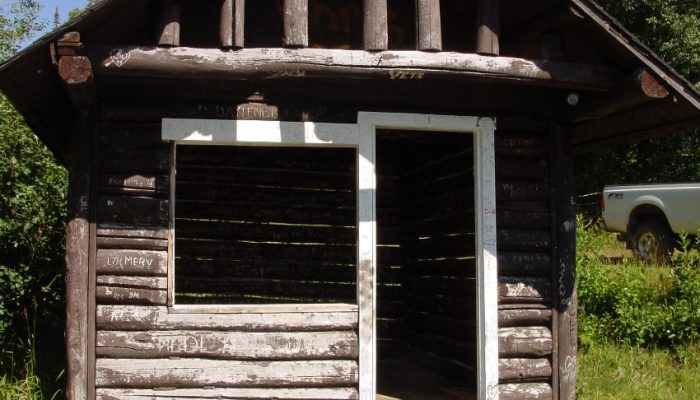


McBRIDE PEAK HALF-WAY HUT
**** Failure at 5.5km on the Forest Service Road / Teare Lookout Access Road – There continues to be NO vehicle access past the barricaded section of road. Foot or bike traffic can cautiously make their way the short distance to the Lookout. ****
The Half-way Hut Recreation Site is located approximately half-way up the Teare Mountain (McBride Peak) Road.
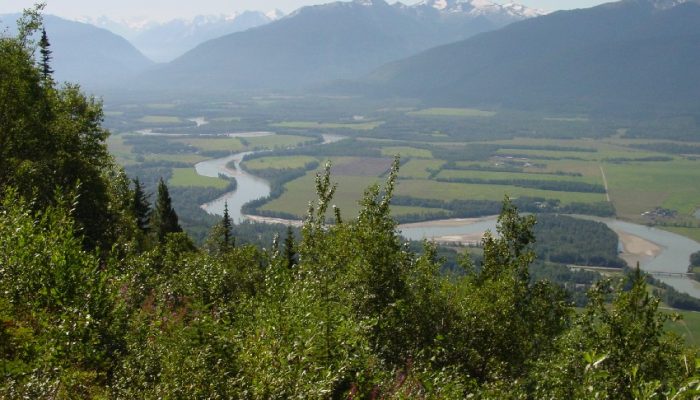
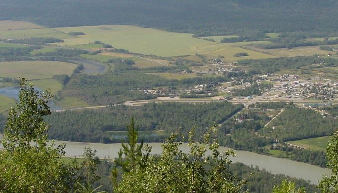
To access this site, head out of McBride East on Highway 16 to Mountainview Road. Turn left onto Mountainview Road and follow along for less than 1 km, then right onto Rainbow Road, which then becomes Teare Mountain Road. Drive up Teare Mountain road for approximately 15 to 20 minutes. Please note that Teare Mountain road is very steep, narrow and rough, with tight switchbacks. It’s entirely dirt and rock. The halfway viewpoint offers stunning panoramics of the Robson Valley – it’s Fraser River and the McBride area. As well as the breath taking Cariboo Mountains to the south/southeast.
This road should not be attempted with motor homes or trailers. Four-wheel drive vehicles are strongly recommended.
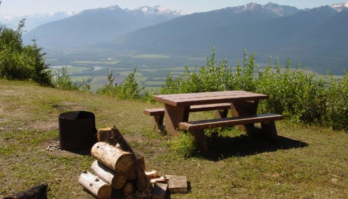
The half-way hut site offers fantastic views of McBride and the surrounding mountains – 2 picnic tables, fire rings, an outhouse, garbage container and the “historic” hut itself.
Those equipped with a suitable 4 wheel drive vehicles may want to venture another 15-20 minutes up to the end of Teare Mountain Road. A short trail leads up from the parking area to the old Forestry Lookout Tower, built in 1930, and McBride Peak.
McBride Peak has an elevation of 2,049m (6,722ft) above the sea level. It’s one of the highest mountain roads of the country. It’s said to be the Canada’s Top Climb. Starting from Yellowhead Highway, the ascent is 12.2 km long. Over this distance the elevation gain is 1.320 meters. The average gradient is 10,81%!
Due to the fragile nature of alpine vegetation, hikers are strongly encouraged to stay on the trail. This is a non-motorized area. ATVs are NOT allowed in this alpine area!